Insurance-grade documentation standards designed for desk review, reinspection requests, and claim verifiability. Not a roofer opinion. Forensic output.
Call (678) 287-7169REQUIRED WHEN HAIL IS ALLEGED
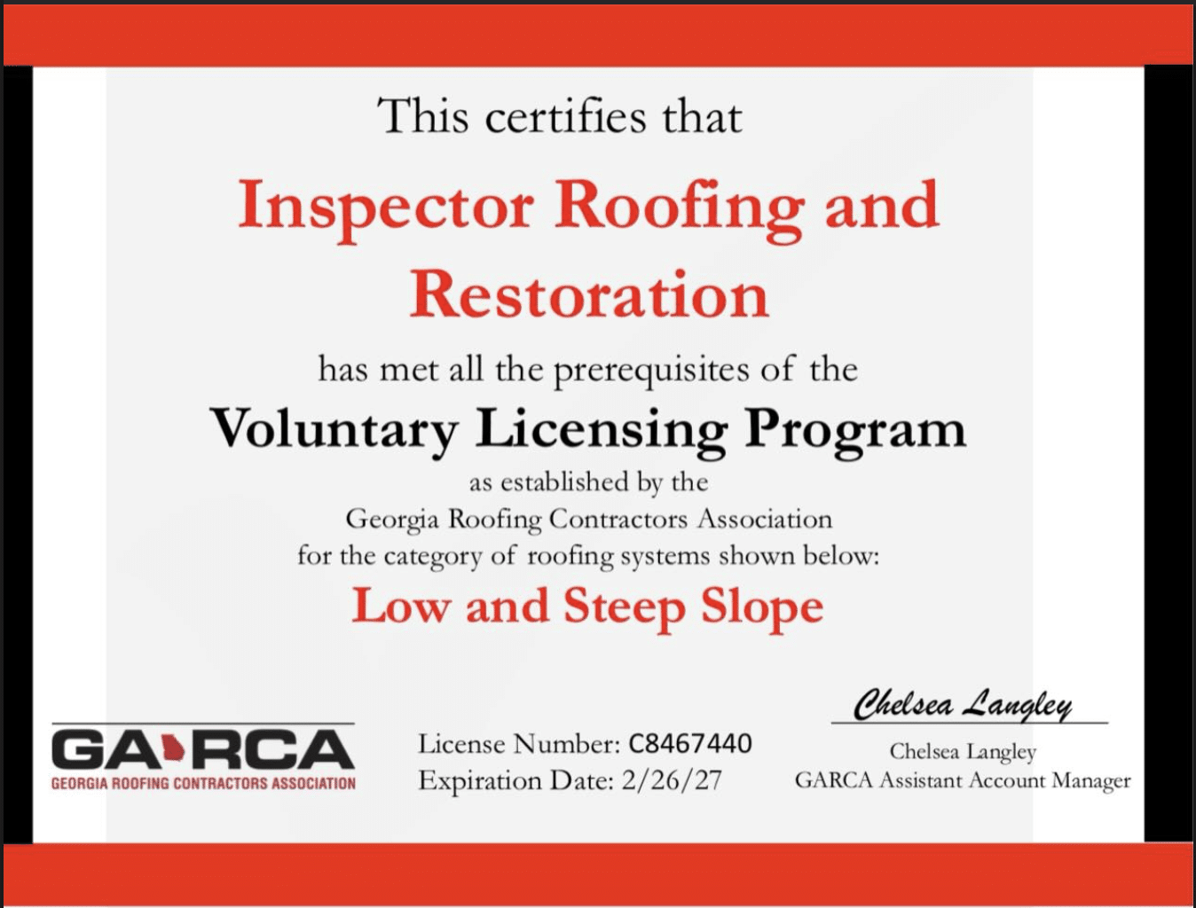
These three principles define how every roof is inspected, documented, and verified at Inspector Roofing and Restoration.
Inspector Roofing Protocols™ Core System Service & Claim Paths
